
The Challenges in Traditional Glaciology and Iceberg Science
Neil L. Rideout
5/20/20264 min read
The Challenges in Traditional Glaciology and Iceberg Science
Icebergs form primarily through calving—the breaking off of ice from glacier termini or ice shelves. Once adrift, they drift with ocean currents, melt, fragment, and influence seawater density, marine ecosystems, and shipping routes. Monitoring them manually is labor-intensive: analysts pore over thousands of satellite images, often under cloud cover or during polar nights when optical data is limited.
Predicting calving events or long-term trajectories involves complex interactions between ice mechanics, ocean warming, atmospheric forcing, and bedrock topography. Models like those in the Ice Sheet Model Intercomparison Project (ISMIP6) rely on high-performance computing but face uncertainties due to sparse in-situ data and computational limits at fine resolutions. Climate-driven acceleration of ice loss in Greenland and Antarctica amplifies the need for better tools. AI addresses these gaps by scaling analysis and improving foresight.
AI for Automated Detection and Tracking of Icebergs
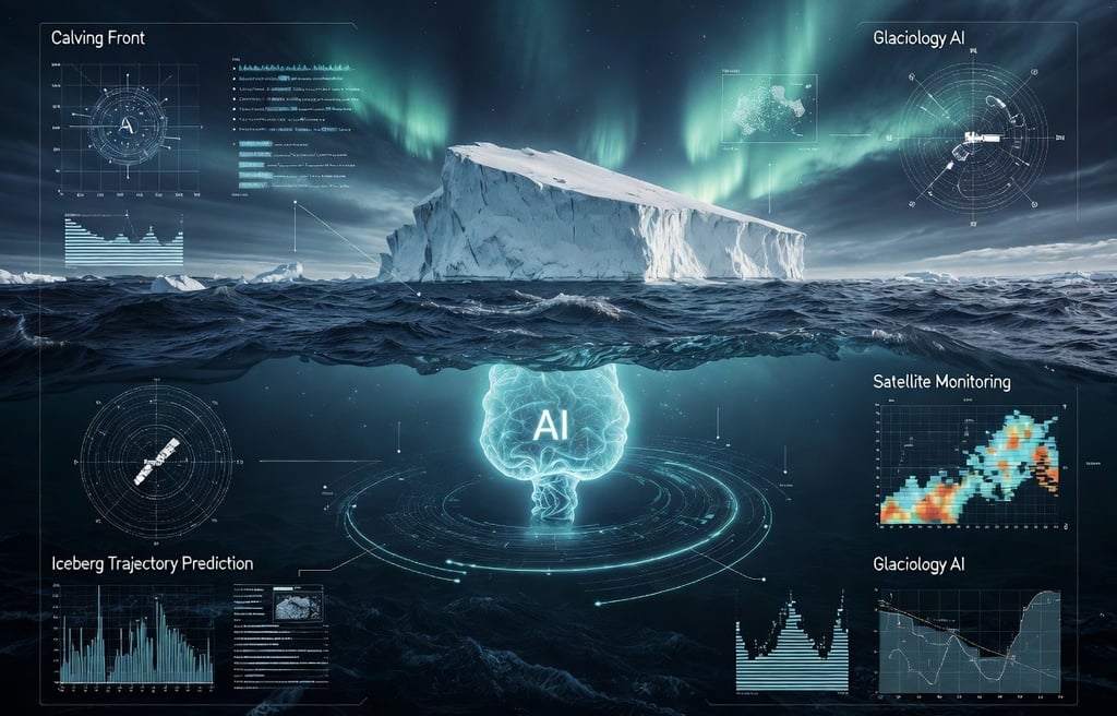
One of the most exciting advances is AI-powered iceberg detection and lifecycle tracking. The British Antarctic Survey (BAS) has developed pioneering AI tools that automatically identify icebergs in satellite imagery, assign them unique identifiers at calving, and track them—including their “child” fragments after breakup—across the Southern Ocean.
Using convolutional neural networks (CNNs) and architectures like U-Net on Sentinel-1 synthetic aperture radar (SAR) data, these systems map icebergs 10,000 times faster than humans while handling challenging conditions such as sea ice packs. SAR’s all-weather, day-night capability is crucial for polar regions. The AI creates detailed “family trees” of icebergs, linking fragments back to parent ice masses, providing new insights into freshwater input, melt rates, and ocean freshening.
Similar efforts use deep learning on optical and multi-spectral data for calving front monitoring. Researchers have applied models to extract glacier termini positions from Landsat, Sentinel-2, and PlanetScope imagery with high accuracy, generating decades-long records of retreat in regions like Svalbard.
Predictive Modeling: Forecasting Calving and Trajectories
Beyond detection, AI excels at prediction. Machine learning models integrate satellite observations, reanalysis climate data, ocean variables, and ice velocity measurements to forecast instability. Deep learning approaches have been trained to predict large calving events on Antarctic ice shelves like Larsen C, using time-series data to identify precursors.
For trajectories, AI-enhanced numerical models combine physics-based simulations with data assimilation. Reinforcement learning or hybrid physics-informed neural networks (PINNs) can optimize predictions of drift paths, accounting for currents, winds, and melting. This has direct applications for maritime safety—issuing alerts for icebergs threatening shipping lanes—and for understanding carbon cycling, as melting icebergs release nutrients and influence phytoplankton blooms.
Generative AI and GANs (Generative Adversarial Networks) are also used to create high-resolution surface melting maps over Antarctica by merging regional climate models with remote sensing, overcoming resolution limitations in traditional outputs.
Broader Applications in Glaciology
AI’s impact extends across glaciology:
Glacier Mapping and Inventorying: Ensemble machine learning classifiers map debris-covered glaciers using multi-source satellite data, achieving over 90% accuracy in complex terrains like the Eastern Pamir.
Snow Cover and Mass Balance: Supervised ML classifiers on Landsat and Sentinel imagery automate snow line detection, yielding detailed accumulation area ratio time series critical for mass balance assessments.
Ice Flow and Dynamics: ML accelerates glacier modeling while maintaining fidelity, helping simulate future evolution under various climate scenarios more rapidly.
Hazard Assessment: Models simulate calving-induced tsunamis and outburst floods, combining continuum damage mechanics with AI for faster risk evaluations in fjords and coastal areas.
These tools process petabytes of Earth observation data from missions like Copernicus, Landsat, and ICESat-2, turning raw imagery into actionable scientific knowledge.
Benefits for Science, Society, and Policy
AI brings speed, scalability, and objectivity. What once took teams of experts months can now occur in near real-time, enabling continuous monitoring of remote regions. It reduces human bias in manual delineations and uncovers non-linear patterns invisible to traditional statistics.
For society, improved iceberg and glacier predictions enhance early warning systems for sea-level contributions, support sustainable shipping in the Arctic, and inform infrastructure planning in polar-adjacent communities. Better models feed into IPCC reports and national climate assessments, strengthening global policy responses.
Democratization is another plus: open-source tools and platforms like Google Earth Engine lower barriers for researchers in developing nations studying mountain glaciers in the Himalayas or Andes.
Limitations and Challenges
Despite progress, challenges remain. AI models can inherit biases from training data, which is often sparse in underrepresented regions or extreme events. “Black box” opacity complicates validation against physical laws—hence the rise of physics-informed AI. Computational demands for training large models are significant, raising energy consumption concerns in sustainability-focused fields.
Data quality issues—cloud contamination, sensor degradation, or inconsistent labeling—require robust preprocessing. Ethical considerations include equitable access to AI tools and ensuring predictions do not create overconfidence in uncertain projections. Human expertise remains essential for interpretation, ground-truthing, and contextualizing results within broader Earth system science.
The Future: Integrated AI-Glaciology Ecosystems
Looking ahead, multimodal AI combining satellite, drone, in-situ sensors, and climate models will create digital twins of major ice sheets. Real-time forecasting dashboards, edge AI on satellites for onboard processing, and quantum-enhanced simulations could further revolutionize the field. Collaborative initiatives like AI4IS (AI for Ice Sheets) point toward community-driven, open models.
As climate pressures intensify, AI-augmented glaciology offers hope for more accurate risk assessments and adaptive strategies. From tracking a single iceberg’s journey to modeling the Antarctic Ice Sheet’s fate, these technologies illuminate the cryosphere’s complexities like never before.
Glaciologists stand on the cusp of a new era—one where AI acts not as a replacement for field science and physical understanding, but as a powerful amplifier. By harnessing these tools responsibly, we gain deeper foresight into one of Earth’s most vital and vulnerable systems, ultimately helping safeguard our planet’s future.
Contact
Head Office
Green Life Enterprises LLC
7175 E. Camelback Road
Suite 707
Scottsdale, Arizona 85251
greenlifedatacenters@gmail.com
+1-813-220-0001
© 2026. All rights reserved.
Canadian Office
Green Life Enterprises LLC
3142 Nicholson Ave
Suite 10
New Waterford, Nova Scotia B1H 1N8